What You Can See From A Mount Maunganui Skydive
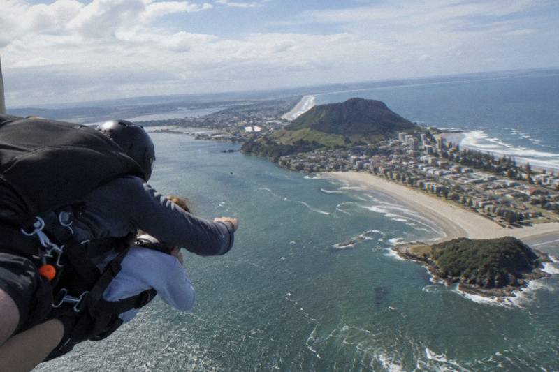
The jump from Tauranga Airport puts you above one of the most compact view corridors in the North Island: a 232 metre volcanic cone, a 20 kilometre sandbar island, a harbour, a mountain range and kiwifruit country, all inside a 20 minute climb.
Short answer
From a tandem skydive out of Tauranga Airport you look down on Mauao at 232 metres, Matakana Island stretching about 20 kilometres along the coast, Tauranga Harbour, the Kaimai Range with Mount Te Aroha at 953 metres, and the Te Puke kiwifruit orchards. Cloud and haze on the day decide how much of it is visible.
The skydive listings that fly out of Tauranga Airport all share one thing: the drop zone sits almost on top of the landmarks people come to look at. The tandem jumps from that airport take off and land on the Mount Maunganui side of the harbour, which means the scenic climb to altitude, the freefall and the several minutes under canopy all pass over the same patch of coastline. What follows is a landmark by landmark account of what is below you, how much of it altitude and timing change, and what cloud can do to the whole picture.
| Fact | Detail |
|---|---|
| Takeoff and landing point | Tauranga Airport, Mount Maunganui |
| The mountain below you | Mauao, 232 metres high |
| The long island on the coast | Matakana Island, about 20 kilometres long |
| The range inland | The Kaimai Range, highest point Mount Te Aroha at 953 metres |
| Climb to altitude | 15 minutes to 12,000 ft, 20 minutes to 15,000 ft |
| Freefall | Up to 40 seconds at 12,000 ft, about 1 minute at 15,000 ft, indication only |
| Canopy ride | 3 to 5 minutes |
| Time on site | 1.5 to 2 hours, arrive 30 minutes early |
What Can You Actually See From A Mount Maunganui Skydive?
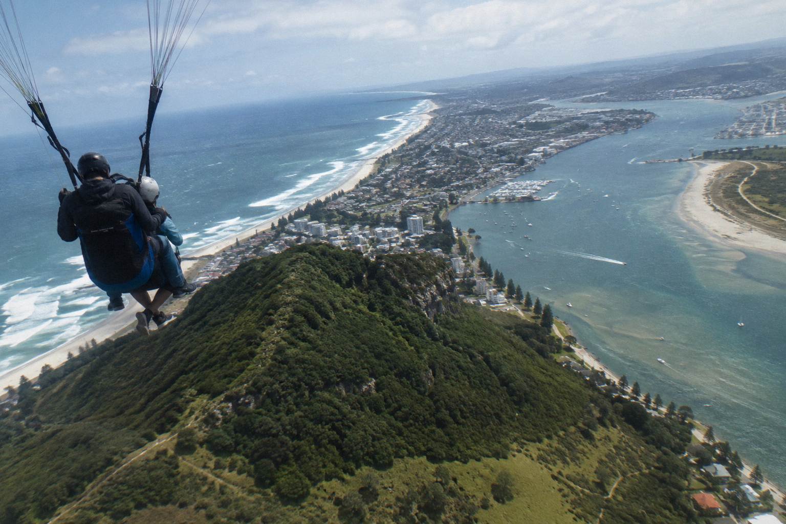
From altitude you see Mauao, the 232 metre volcanic cone that gives the town its name, Matakana Island running roughly 20 kilometres along the coast, the arms of Tauranga Harbour, and the Kaimai Range inland with Mount Te Aroha at 953 metres. On clear days the kiwifruit country around Te Puke appears to the southeast, and since takeoff and landing happen beside the harbour, the view stays beneath you the entire flight.
Mauao is the anchor. The cone rises 232 metres directly from the harbour mouth, and the Wikipedia page on the mountain records that elevation as its summit height. From the exit altitude of 12,000 or 15,000 ft, a 232 metre hill is a small shape on the shoreline, but it is the shape that orients everything else: the beach running north from its base, the harbour entrance on one side, the port and city on the other. The jump listings are careful on one point worth repeating: the beach is a view. The aircraft lands back at the airport, not on the sand.
Matakana Island is the second orientation marker. It lies along the open coast, about 20 kilometres long according to the Wikipedia page on the island, a slender sandbar separating the Pacific from Tauranga Harbour. From altitude a 20 kilometre island reads as a pale line with the harbour behind it, which is exactly why it helps you work out which water is which: ocean in front of the bar, estuary behind.
Inland, the Kaimai Range closes the frame. Its highest point, Mount Te Aroha at 953 metres per its Wikipedia entry, sits well above anything between the coast and the range, so on a day with good visibility the ridge line is the unmistakable inland edge of the view. Between the airport and the hills lies the working plain: harbour, suburb, orchards. The scenic flight listings from the same operator describe the Te Puke kiwifruit orchards among their route highlights, and that orchard country is the same green patchwork you look across from a skydive.
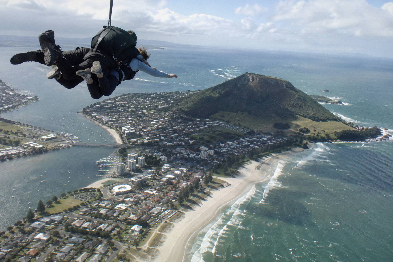
The From Tauranga: Skydive over Mount Maunganui listing, rated 5.0 from 66 reviews, is the jump product built around exactly this view corridor, with a 20 to 25 minute scenic flight to altitude before the exit. You can compare it against the other airport jump listings on how the two jump heights compare, since the height you buy changes both the freefall and the climb, and the climb is where most of the looking happens.
How High Are You, And How Long Do You Have To Look?
Two altitudes are sold: 12,000 ft and 15,000 ft. The 12,000 ft option gives a 15 minute scenic flight and up to 40 seconds of freefall; the 15,000 ft option gives a 20 minute scenic flight and about 1 minute of freefall. After the parachute opens you spend 3 to 5 minutes under canopy. The operator states that freefall times are an indication only and vary with conditions and body shape.
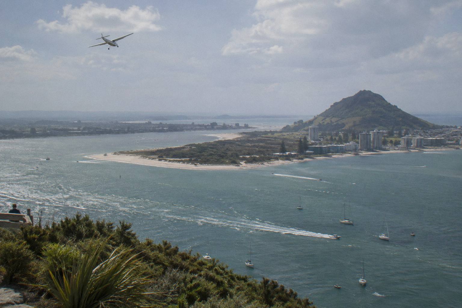
The practical point for a view buyer is that the sightseeing is front loaded. The climb in the Cessna 182, which carries two tandems at a time, takes 15 or 20 minutes depending on the altitude you chose, and during that climb the aircraft is working its way up over the coastline. That is the window in which you can study Mauao, track Matakana Island end to end and pick out the Kaimai Range, all while seated and unhurried.
Freefall is different. Up to 40 seconds at 12,000 ft, about a minute at 15,000 ft: enough to register the whole harbour and the coast in one sweep, not enough to study detail. The operator notes speeds of over 200 km/h in freefall, and at that speed the view is a panorama rather than a map. Many jumpers say afterwards that the freefall went by faster than expected and that the canopy ride is when the scenery actually registered.
The canopy segment, 3 to 5 minutes depending on conditions, is the second good viewing window. The instructor steers back toward the airport landing area, which keeps the descent over the same harbour and coastline you climbed over. Tauranga Skydive describes the parachute ride on its what-to-know page as the stretch to breathe and take in the surroundings, and that matches the geometry: a slow descending arc above the harbour with the cone, the island and the range all still in frame.
If the view is the reason you are booking rather than the freefall, the 15,000 ft listings argue for themselves on arithmetic alone: five extra minutes of climbing and roughly twenty extra seconds of freefall, over the same scenery. See the full comparison of the two jump heights for how the trade offs stack up, and check the live price and calendar for your date on the skydive over Mount Maunganui tour page or Check availability.
| Segment | 12,000 ft option | 15,000 ft option |
|---|---|---|
| Scenic climb | 15 minutes | 20 minutes |
| Freefall | Up to 40 seconds, indication only | About 1 minute, indication only |
| Canopy ride | 3 to 5 minutes | 3 to 5 minutes |
| Total time on site | 1.5 to 2 hours | 1.5 to 2 hours |
| Aircraft | Cessna 182, two tandems | Cessna 182, two tandems |
The Landmarks Below You, Ranked By How Hard They Are To Miss
Mauao is the landmark you cannot miss, a 232 metre cone at the harbour mouth that anchors the whole scene. Second is Matakana Island, a sandbar about 20 kilometres long lying just off the coast. Third is Tauranga Harbour itself, wrapping around the airport. Fourth is the Kaimai Range inland, and fifth the Te Puke orchard country to the southeast. Each is identifiable by shape rather than detail, because at exit altitude everything compresses into a map view.
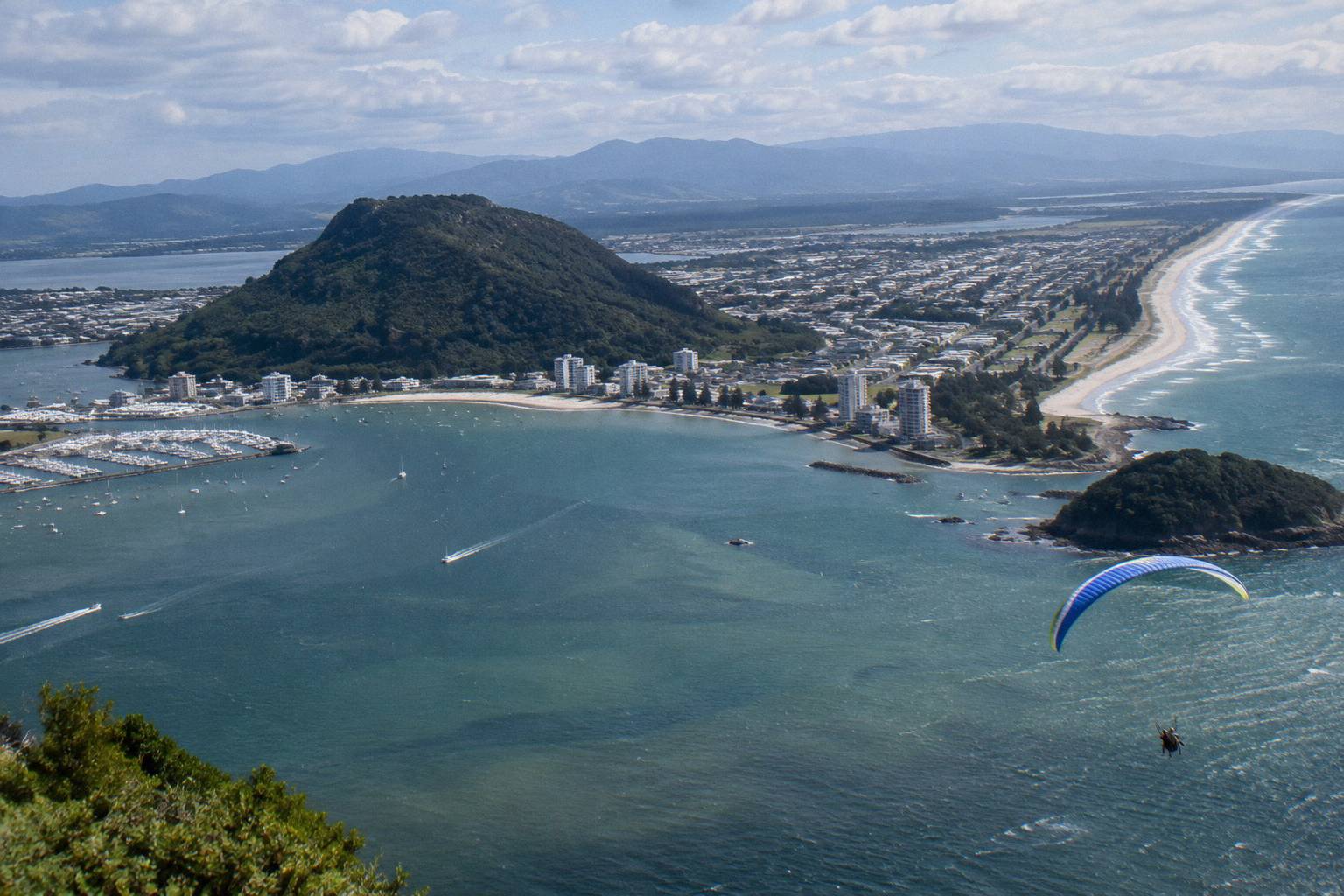
The table below is the checklist to carry in your head. Sizes are from the referenced sources, not estimates.
| Landmark | Size or fact | Reference |
|---|---|---|
| Mauao | 232 metres high, rises at the harbour mouth | the Wikipedia page on the mountain |
| Matakana Island | About 20 kilometres long | the Wikipedia page on the island |
| Kaimai Range | Highest point Mount Te Aroha, 953 metres | the Wikipedia page on the range |
| Tauranga Airport | Beside Tauranga Harbour, about 3 km northeast of the CBD | the Wikipedia page on the airport |
| Te Puke orchards | Kiwifruit country southeast of the harbour, named on the scenic flight listings | operator scenic flight listings |
Reading the table in the air is straightforward. Find the cone first: nothing else on the coast has that shape. The beach attached to its base runs out to the sandbar island, and the island runs for roughly 20 kilometres, so its far end disappears toward the horizon rather than terminating in view. The harbour is the water between the island and the airport, braided and shallow looking from above. The range is the long inland wall; its highest summit at 953 metres is barely a fifth of your exit altitude, which is why the hills read as texture rather than peaks.
The orchards need a clear day and a southeastward glance. The operator's own scenic flight from the same airport names the Te Puke kiwifruit orchards among its route features, and the same patchwork sits inside the skydive's view cone. On a hazy morning it merges into general green; on a clear one the pergola lines of a kiwifruit block are visible as regular geometry, which is how you tell orchard from native bush at a glance.
One more orientation fact worth knowing: the airport itself is small and sits right on the harbour, about 3 kilometres from the city centre. That is why the view starts before the aircraft has even left the circuit. You are never more than a couple of minutes of flight from every landmark on the list.
Does The Altitude Change The View?
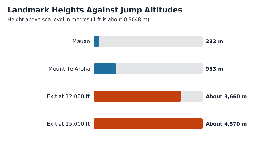
Yes, but less than you would guess, and more in quality than in extent. At 12,000 ft you see the same landmarks as at 15,000 ft; at 15,000 ft they sit at a slightly flatter angle, haze matters more because you are looking through more air, and the horizon runs a little further out. The bigger differences are time based: five more minutes of climbing and roughly twenty more seconds of freefall.
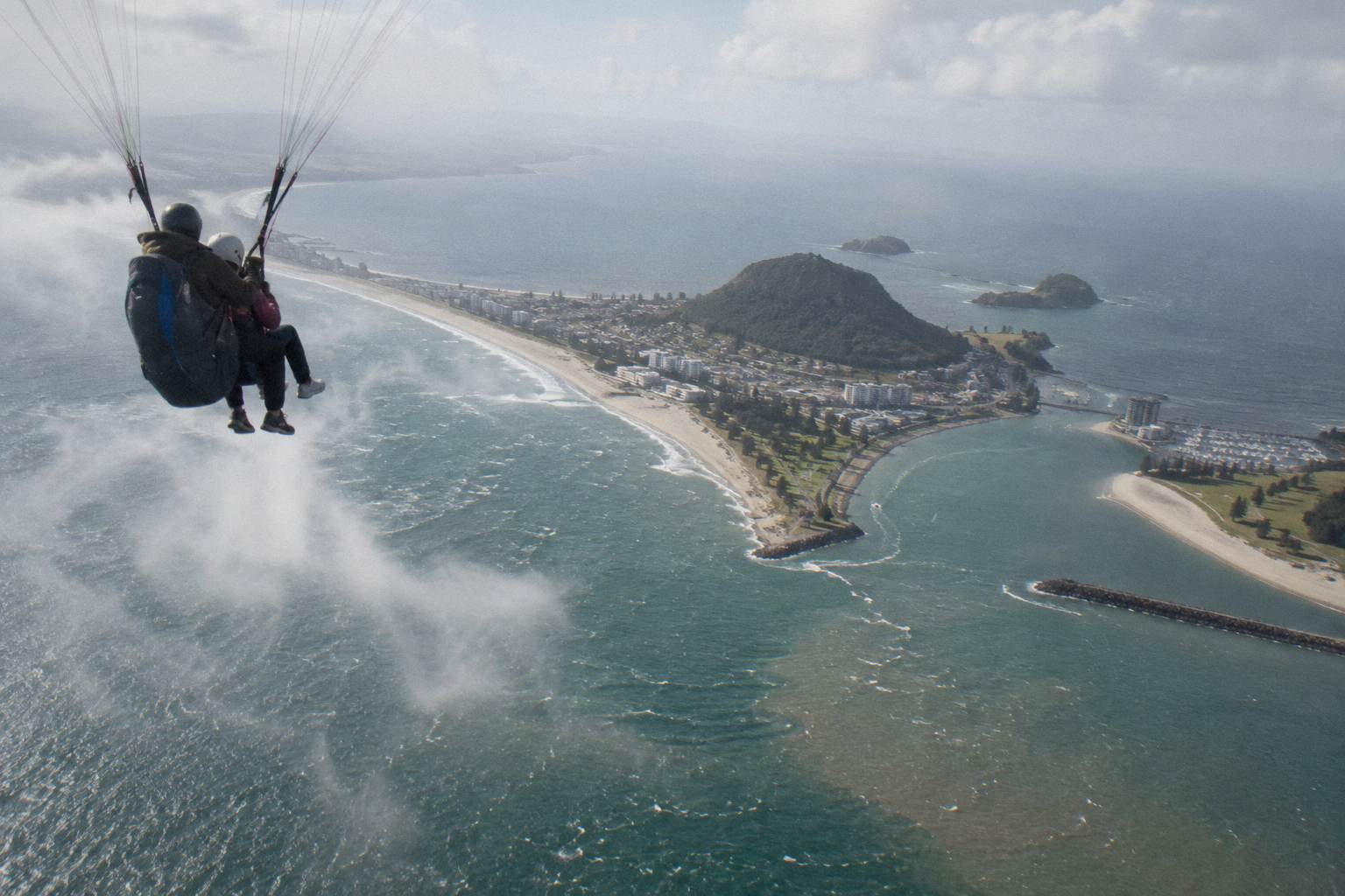
The geometry is simple. Mauao at 232 metres and Mount Te Aroha at 953 metres are both small fractions of either exit altitude, so neither changes character between the two options. What changes is the angle: at 15,000 ft the coastline flattens further into a plan view, which favours the big shapes, the island, the harbour arms, the range, over surface detail. Detail, such as the summit track on the cone or individual orchard blocks, reads better from lower down, which is partly why the canopy ride at a few thousand feet gives the sharpest looking of the whole experience. The wider set of guides lives on Tauranga Skydive.
Haze is the real variable. The extra 3,000 ft buys you more distance, and distance is exactly what atmospheric haze eats. On a clear morning the higher exit shows more of the horizon; on a milky one the extra altitude mostly shows more milky air. Tauranga averages around 2,400 sunshine hours a year and January is its sunniest month, but a sunny statistic is not a forecast for your jump day, and no operator can promise visibility.
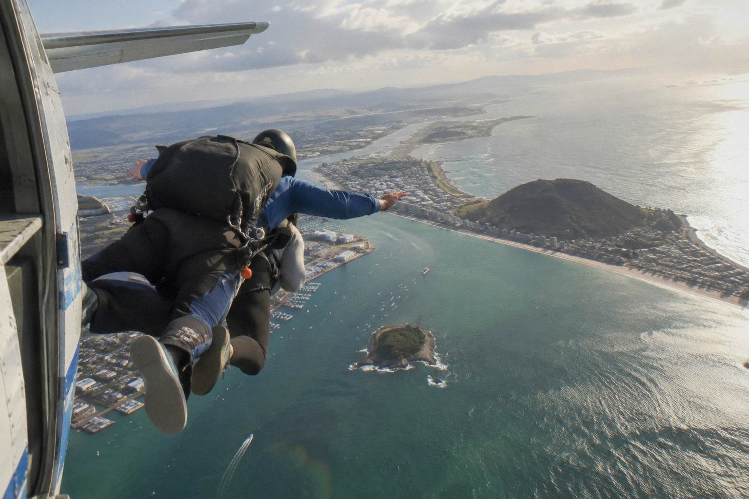
The freefall difference, up to 40 seconds versus about 1 minute, changes how the view arrives. In both cases the ground rushes up as a whole rather than as a sequence, but the longer fall gives your eyes time to settle from the rush to the panorama. The operator states plainly that freefall times are an indication only, varying with weather and body shape, so plan around the scenery windows, the 15 or 20 minute climb and the 3 to 5 minute canopy ride, rather than around the seconds of freefall.
What Do Cloud And Weather Do To The View?
Cloud decides the view, full stop. Low cloud can hide the coastline entirely, mid level cloud can put you above a grey floor with only brief gaps, and haze can keep the flight legal while washing the Kaimai Range out of the picture. The operator calls jumpers on the day when the weather looks poor and works out a plan that fits, and every listing carries free cancellation up to 24 hours before the start.
This is the section to read before you promise anyone a postcard. Skydiving aircraft operate under visual conditions, and the conditions that ground jumps, low cloud, strong or gusty wind, rain, are the same conditions that degrade the view even when a jump goes ahead. A flight that climbs between cloud layers can be safe and scenic straight down but grey toward the horizon. A windy but clear day can give sharp visibility and a fast, bumpy ride. These outcomes are normal, not exceptions.
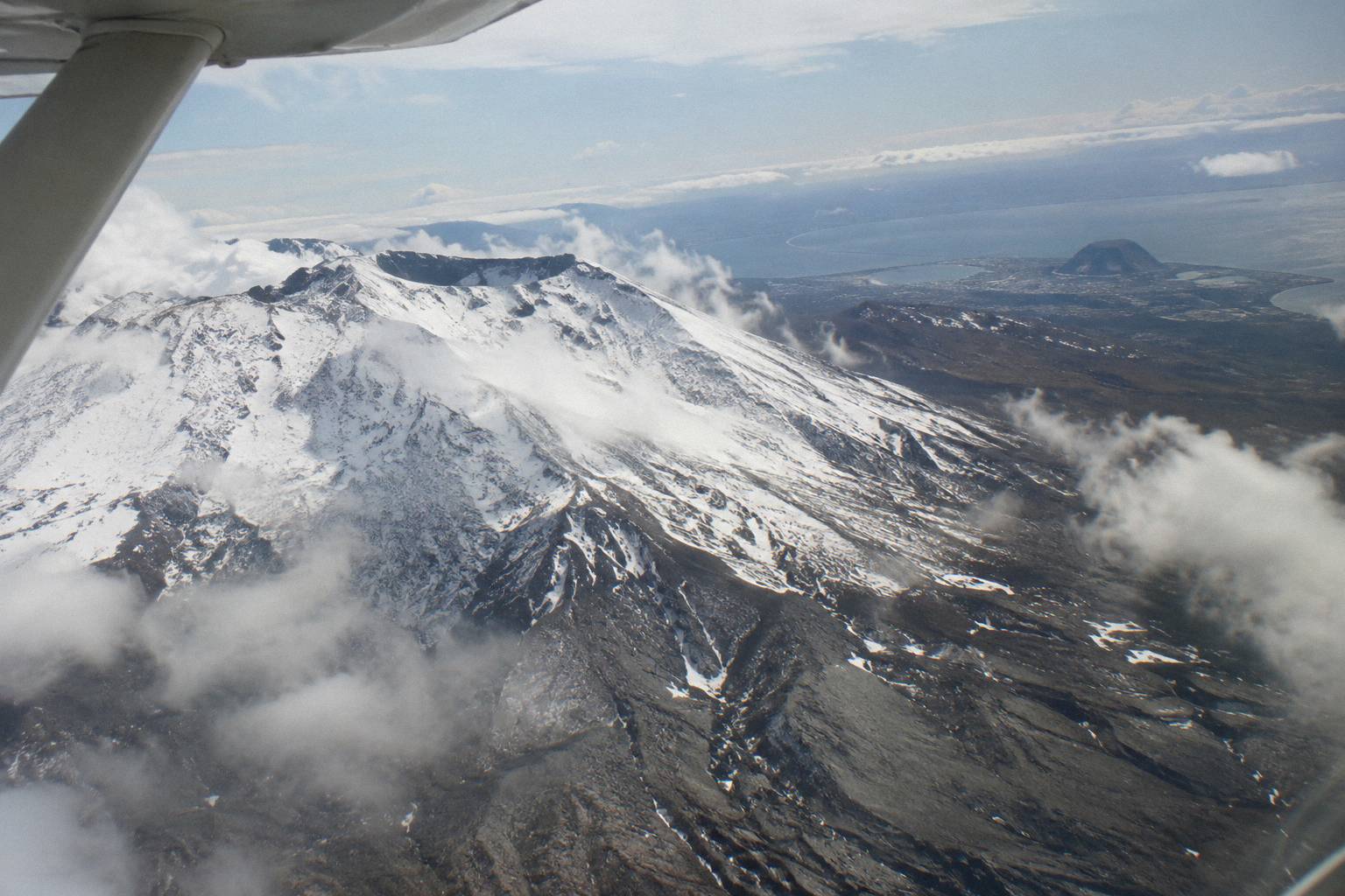
The operator's own handling of this is stated on its FAQ page: if the weather does not look good, staff call on the day of the jump and work something out with you to fit your schedule. For planning purposes that means two things. First, keep your jump day flexible if you can, because a moved jump is a common outcome, not a failure. Second, the booking-page cancellation terms, free up to 24 hours before the start, give you an exit if the forecast turns and your schedule cannot.
The detailed version of this, including how cancellations and weather holds interact, is in the guide to weather and cancellations. For a view buyer the short version is: book the earliest date window you can afford to shift, check the forecast the evening before, and answer the phone on the morning.
Can You Get The Same Views Without Jumping?
Yes, you can, and the comparison is fair. The same operator flies a 30 minute fixed wing scenic flight over Mount Maunganui and a two hour flight toward Mount Ruapehu, while helicopter operators run from the same airport area. A scenic flight keeps you in the aircraft the whole trip with a window the entire time; the skydive trades that continuous window for freefall and the canopy descent.
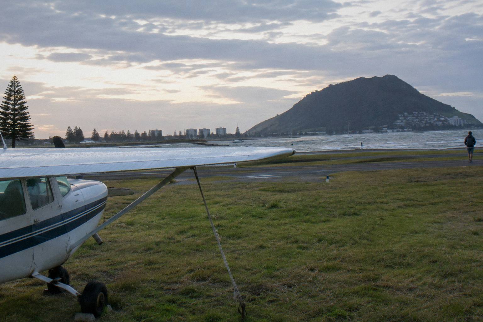
The Mount Maunganui Scenic Flight is the closest like for like: a 30 minute fixed wing flight departing the same airport, flown by the same operator, covering the cone, the harbour and the coast. Longer fixed wing trips push further out, including the Coromandel and Cathedral Cove Scenic Flight at 1.5 hours and the Two-Hour Ruapehu Scenic Flight toward Mount Ruapehu, which no local skydive can match for inland range. The one helicopter product from Tauranga is the Cathedral Cove coastal tour, 2.5 hours door to door with about 1.5 hours flying, and a Taupo combo pairs a helicopter flight with a 15,000 ft skydive. If the view alone is the purchase, the scenic side of the ledger deserves a look, and the comparison of a skydive versus a scenic flight works through the trade offs.
What the scenic flights cannot give you is the sequence: the door, the exit, the minute of freefall toward that same coastline, and then the quiet of the canopy ride. Many view buyers end up glad of the longer scenic climb precisely because it bridges the two products: 15 or 20 minutes of window seat sightseeing, then the jump. If that combination is the appeal, the Mount Maunganui skydive listing is built around it.
For a different view corridor altogether, the Taupo listings are worth a glance: Lake Taupo is New Zealand's largest lake at 616 square kilometres, an entirely different scale of landmark from Matakana Island. The comparison of Tauranga and Taupo skydives lays out what changes, including the drive of roughly 143 km between the two towns.
What Trips People Up Before You Book?
Three things catch buyers out: expecting a beach landing when the aircraft actually lands back at the airport, the beach is only ever a view; building the day around the freefall seconds rather than the scenic climb and canopy time where the scenery actually lives; and forgetting that weather moves jumps, so a rigid same day itinerary turns a routine reschedule into a lost booking.
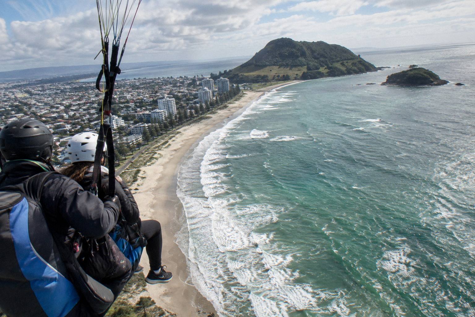
The beach confusion is worth a paragraph of its own because it feeds expectation from outside sources. Some skydive operations elsewhere land on sand; this one does not. Takeoff and landing are both at Tauranga Airport, and the operator notes its landing area is small, with airport rules to coexist with scheduled airline traffic. Everything you may have read about the beach happens in the air, not on it.
The timing confusion is about how the hour and a half divides up. A small fraction of it is freefall. The largest single block is ground time and the climb, and the second largest is the canopy ride. Planning your day around those blocks, rather than around the freefall figure in the title of the listing, is the difference between a relaxed morning and a rushed one. Cruise passengers should note the operator's own estimate that the airport is a 5 to 10 minute drive from the cruise dock, which makes the timing work, but the cruise stop planning guide covers the margins in detail.
The clothing one is simple but strict: closed shoes that cannot fall off are mandatory for everyone. The operator supplies a jumpsuit when wanted, plus hat and goggles, and goggles that fit over glasses are available. Comfortable, weather appropriate clothes complete the list. None of this affects the view, but all of it affects whether you get on the aircraft.
A final planning note: if the view is the gift rather than the purchase, the operator's vouchers are valid for a year and can be transferred, which suits a landmark heavy present like this one. The gift voucher guide works through the details.
Common Questions About The View From A Tauranga Jump
What Can You See From A Mount Maunganui Skydive?
Mauao at 232 metres, Matakana Island stretching about 20 kilometres along the coast, Tauranga Harbour, the Kaimai Range with Mount Te Aroha at 953 metres, and, on a clear day, the Te Puke kiwifruit orchards. Cloud and haze on the day decide how much of this is visible.
Do You Land On The Beach After The Jump?
No. The aircraft takes off and lands at Tauranga Airport, Mount Maunganui. The beach is a view from the air only, and the operator notes its landing area is a small one at the airport.
Does 15,000 Ft Give A Better View Than 12,000 Ft?
The same landmarks are visible from both altitudes. The 15,000 ft option adds about five minutes of scenic climbing and roughly twenty extra seconds of freefall, while haze can offset the benefit of the extra height on a milky day.
How Long Do You Have To Look At The Scenery?
The scenic climb runs 15 minutes to 12,000 ft or 20 minutes to 15,000 ft, and the canopy ride lasts 3 to 5 minutes. Freefall, up to 40 seconds or about a minute, is fast and panoramic rather than detailed.
What Happens To The View If The Weather Is Bad?
Cloud, wind and rain can hide the coastline or move the jump entirely. The operator calls jumpers on the day when the weather looks poor and works out a plan, and the listings carry free cancellation up to 24 hours before the start.
Can You Get Similar Views Without Skydiving?
Yes. The same operator flies scenic fixed wing tours from Tauranga Airport, including a 30 minute flight over Mount Maunganui, a 1.5 hour Coromandel and Cathedral Cove flight and a two hour flight toward Mount Ruapehu. Helicopter options are the 2.5 hour Cathedral Cove coastal tour, plus a Taupo helicopter and skydive combo.